Object detection
Locate supported objects or regions in an image, such as tanks, vehicles, rooftops or field features.
AI object detection & classification
Satvitech applies computer-vision workflows to suitable satellite and aerial images to detect, classify, and organise visible objects or features according to a defined analysis objective.
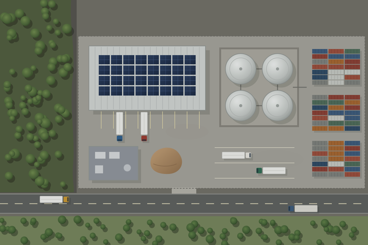
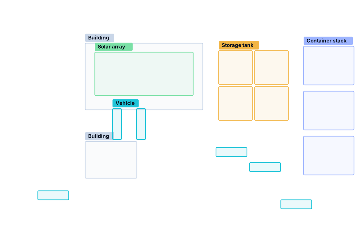 Example visualisation
What the service can include
Not every project needs every output. Formats and categories are agreed during scoping.
Locate supported objects or regions in an image, such as tanks, vehicles, rooftops or field features.
Assign defined categories to detected objects or image areas when the data supports reliable separation.
Prepare images with bounding boxes, segmentation masks, labels or other visual annotations where appropriate.
Organise outputs in tables or machine-readable files that slot into your reporting or analysis.
Include positions or spatial attributes when the source imagery is properly georeferenced and the method supports them.
Assess whether a customer-specific class or visual target can be detected reliably enough for your intended use.
Potential application areas
Whether a target is detectable depends on its size relative to the image resolution, the sensor, image quality and your permission to use the imagery. These examples show the kind of features that may be suitable:
How a project works
Agree the target classes and the decision the results will support.
Check source imagery against the expected object size and resolution.
Select, adapt or develop an appropriate computer-vision method.
Review false positives and missed detections against reference examples.
Provide the agreed annotations, data and documentation of limitations.
What affects detection quality?
A detection workflow can only find what the imagery shows clearly. These factors decide what is realistic for each project — we assess them before committing to an approach.
A small object needs a fine enough resolution to cover it with enough pixels to be recognised.
Optical, multispectral and radar sensors show objects differently and need different methods.
Image date, lighting, shadows, viewing angle, haze, cloud cover and overall image quality.
Crowding, occlusion, similar-looking backgrounds and varied object appearance.
Representative examples and clear class definitions matter as much as the model.
How success is measured and how much manual review is appropriate for the use.
Detecting “a vehicle” or “a vessel” describes what is visible in the image. It does not establish which specific object it is, who owns it or what it is used for.
Where results include a model confidence score, it is not automatically a calibrated probability that the detection is correct. We explain how scores were reviewed and what thresholds mean for your use.
Potential outputs
Below is an illustrative output package for the example scene on this page. Every count and box corresponds to the objects drawn in that example image.
Example visualisation| ID | Class | x, y (px) | Size (px) |
|---|---|---|---|
| T-01 | Storage tank | 735, 175 | 100×100 |
| T-02 | Storage tank | 855, 175 | 100×100 |
| T-03 | Storage tank | 735, 295 | 100×100 |
| T-04 | Storage tank | 855, 295 | 100×100 |
| V-01 | Vehicle | 379, 366 | 22×95 |
| V-02 | Vehicle | 459, 366 | 22×95 |
| V-03 | Vehicle | 724, 496 | 95×22 |
Showing 7 of 16 rows. With properly georeferenced imagery, positions can be given as map coordinates instead of pixels.
{
  "image": "example-site.tif",
  "note": "Illustrative output. Pixel bounding boxes refer to the example image.",
  "detections": [
    { "id": "T-01", "class": "Storage tank", "bbox_px": [735, 175, 100, 100], "review": "accepted" },
    { "id": "T-02", "class": "Storage tank", "bbox_px": [855, 175, 100, 100], "review": "accepted" },
    { "id": "S-01", "class": "Solar array", "bbox_px": [322, 180, 316, 132], "review": "accepted" }
  ]
}
FAQ
Visible objects or features that are large enough relative to the image resolution and distinct enough from their surroundings — for example buildings, tanks, vehicles, solar arrays or stockpiles. Each target class is assessed for feasibility before work starts.
No. Many freely available satellite images have pixels several metres across or larger, which is suitable for broad features but not small objects. The required resolution depends on the size of the target and how reliably it must be separated from similar features.
Often, yes — provided you have the right to use them for the analysis, the format is workable, and the imagery has enough quality and detail for the agreed classes.
Yes, when the source imagery is properly georeferenced and its metadata supports it. Otherwise results are given in image (pixel) coordinates, as in the example on this page.
Outputs are checked against reference examples or a reviewed sample. We record false positives and missed detections, explain the limitations, and agree beforehand what level of performance is good enough for your use.
Related services
Object detection is often paired with change detection to see how the objects on a site vary between dates.
Describe what you need to detect, how the results will be used, and any imagery you already have. We will assess whether it can be detected reliably enough.